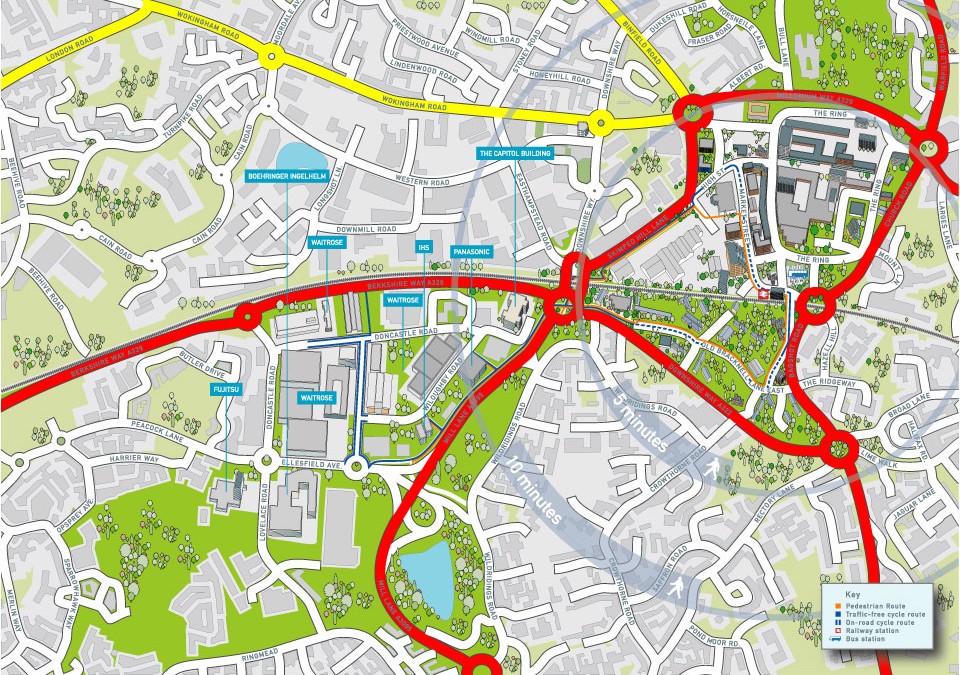
Map of the city centre area of Bracknell showing the network of cycle and walking paths that link the railway station to the southern business park. Part of the brief was also to provide accurate 2d building illustrations of some of the prominent companies that have...
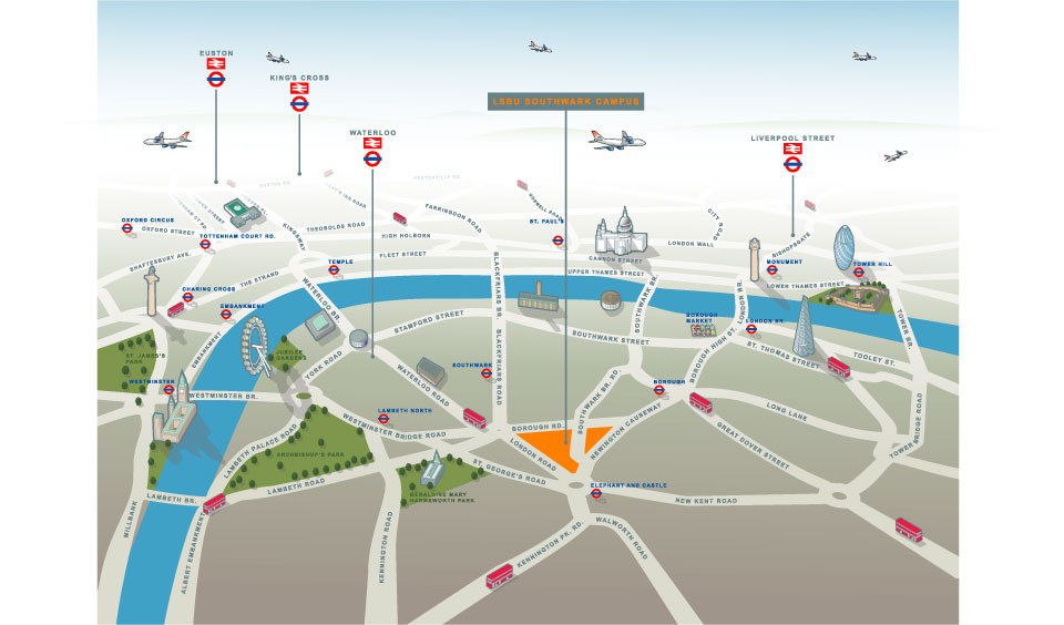
Illustrated map of South London (Southwark Campus of LSBU) and Havering Campus (Romford) This of illustrated map went through a number of incarnations before arriving at this finished result. The client wanted an illustrated map which worked in terms of being able to...
This post represents the processes involved with the design and production of a logo. This is a real job for a property developer just outside Aberdeen, he gave me a completely open brief and below are my initial ideas from which he made his first selection. As with...
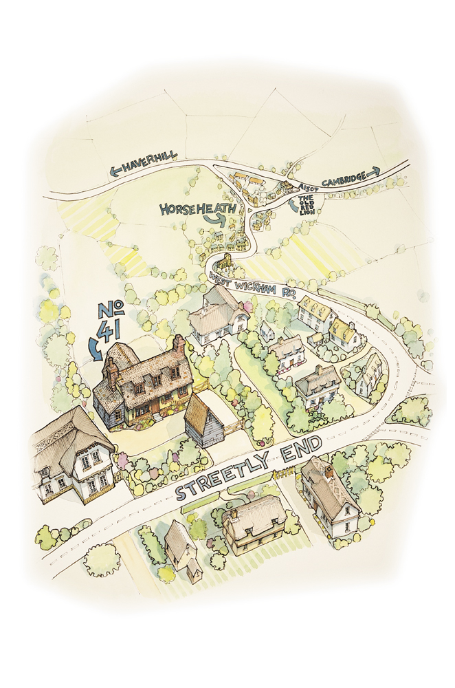
Local accountancy and bookkeeping company Bookeepers Plus approached me with an idea for a ‘how to find us’ type of map, helping to give directions to their new premises. They liked the look of my previous examples of hand drawn illustrated maps, so it...

 Commercial and wedding photography, illustration and graphic design services. Based in Cambridge.