 Hand-drawn illustrated map of the Castle at Cabra in Ireland. This drawing represents the first in a series of five for Romantic Castles Ireland to be used on websites and printed matter for use by potential and actual guests. The isometric nature of the map was...
 From a complex rough sketch from the client I produced this hand drawn map of the Waterside wedding venue showing in detail what sort of entertainments were available for guests on the...
 New illustrations and illustrated maps for a wayfinding project for the town of Halesworth in Suffolk. The project included reworking walking routes which leave from a central point in the...
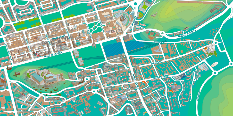 New illustrated map of Edinburgh. Digital map illustration of the central area of Edinburgh featuring both the old and new towns. Edinburgh is Scotland’s compact, hilly capital. It has a medieval Old Town and elegant Georgian New Town with gardens and...
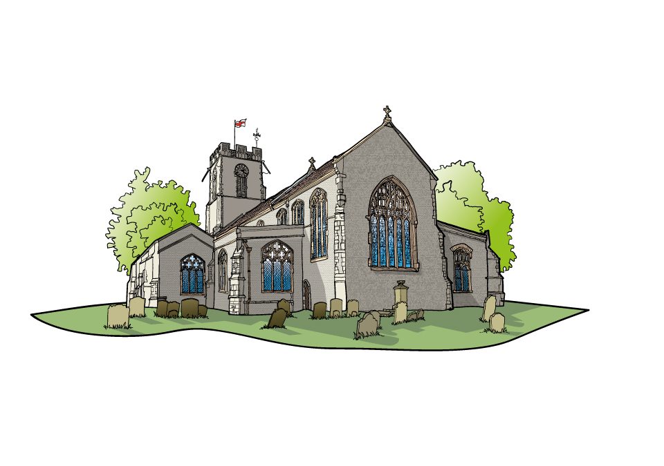
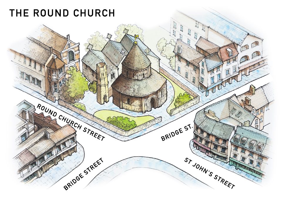 Three illustrated maps for the historic Round Church in Cambridge. Modelled on the Church of the Holy Sepulchre, the Round Church in Cambridge is founded between 1115 and 1131 by ‘the fraternity of the Holy Sepulchre’ and ‘in honour of God and the holy Sepulchre’. No...

 Commercial and wedding photography, illustration and graphic design services. Based in Cambridge.