 Hand-drawn illustrated map of the Castle at Cabra in Ireland. This drawing represents the first in a series of five for Romantic Castles Ireland to be used on websites and printed matter for use by potential and actual guests. The isometric nature of the map was...
 Illustrated map of the golf course and local town of...
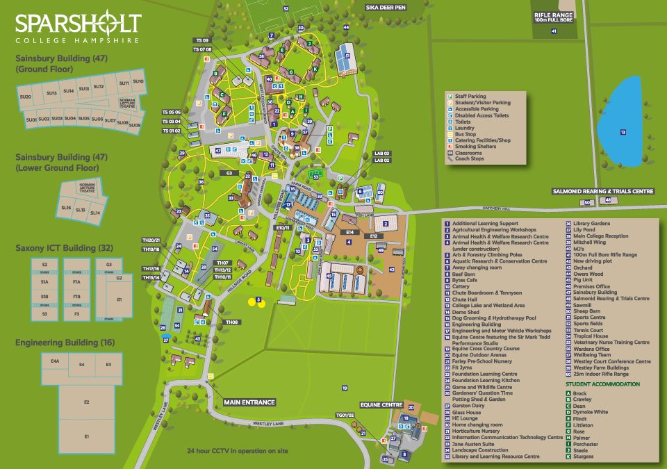 Map showing the key buildings, roads and key for Sparsholt College commissioned by Latitude Maps,...
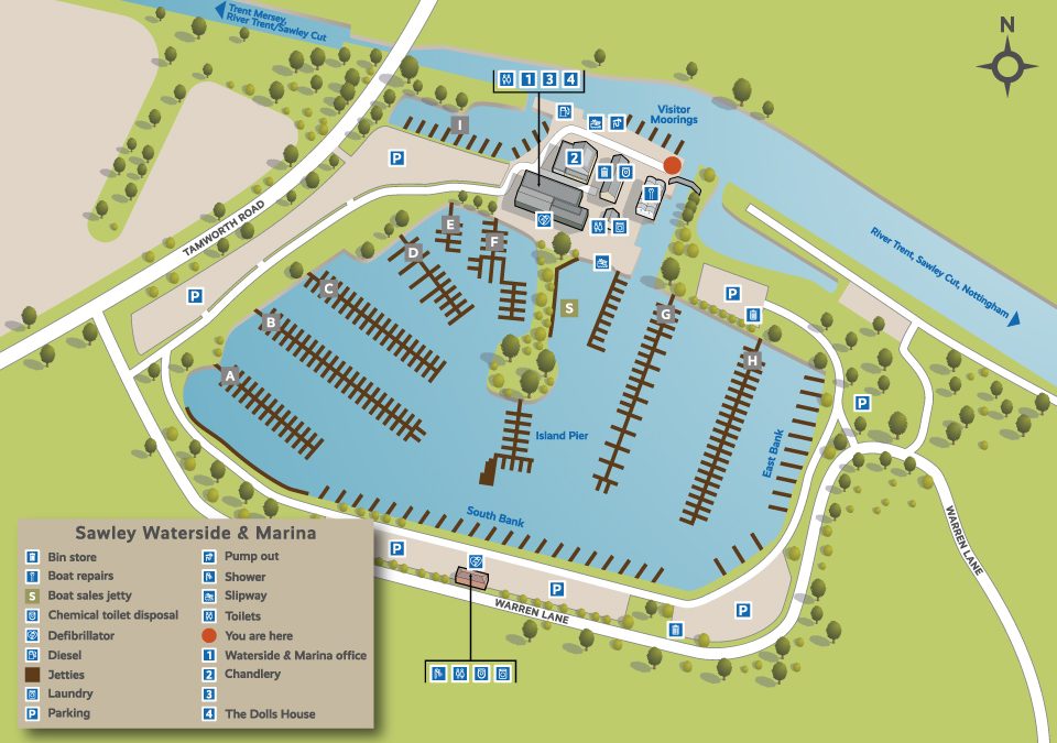 One of a series of 36 illustrative maps for British Waterways/Aquavista. The illustrations feature the marinas owned throughout the UK, I also designed a series of icons to be used throughout in the annotations. The work was commissioned by 3-sixty in...
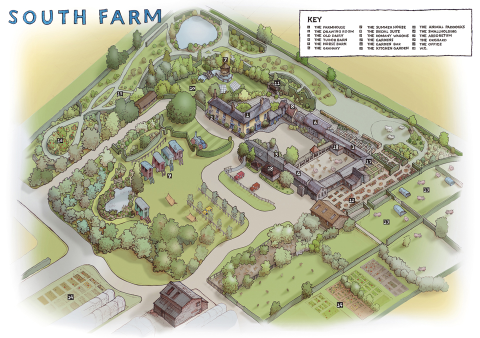 Combination of hand drawn and digital image for the wedding venue South Farm. The original drawing was produced using drone images and my own photographs. This was subsequently coloured up in...

 Commercial and wedding photography, illustration and graphic design services. Based in Cambridge.