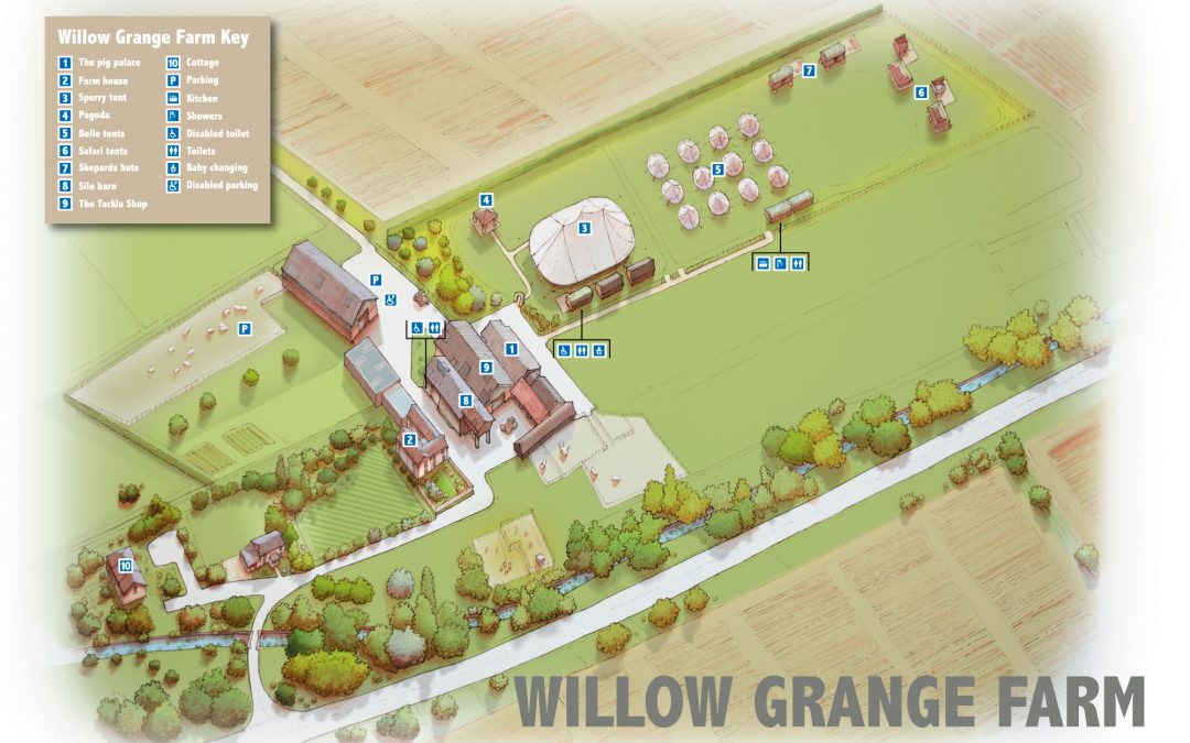
 Illustrated map of the wedding venue Willow Grange Farm near Cambridge. Work was hand-drawn and then coloured up in photoshop and then annotated in...
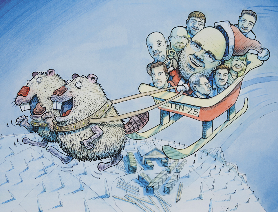 Graphic Design and illustration for advent calendars. The clients were https://www.hexconsultants.com/ , https://www.ten-25.co.uk/...
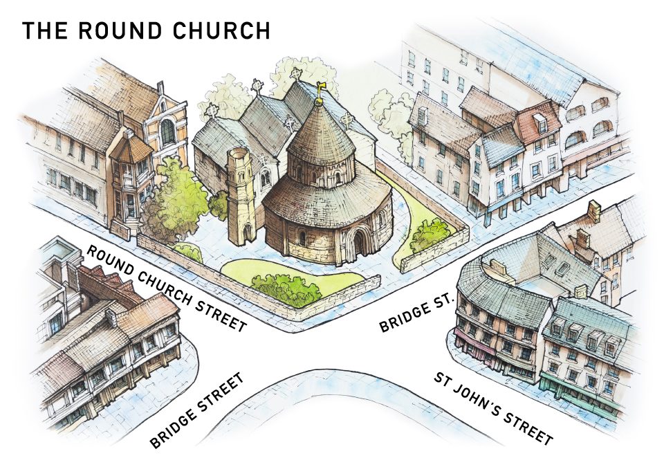 Three illustrated maps for the historic Round Church in Cambridge. Modelled on the Church of the Holy Sepulchre, the Round Church in Cambridge is founded between 1115 and 1131 by ‘the fraternity of the Holy Sepulchre’ and ‘in honour of God and the holy Sepulchre’. No...
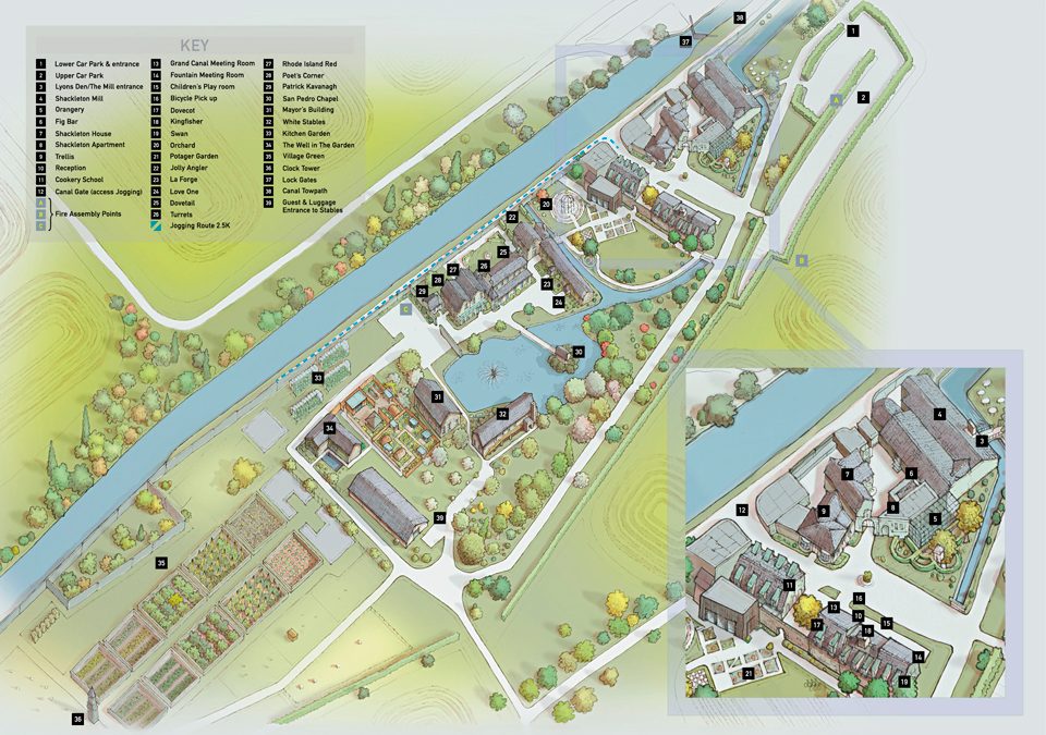 This illustrated map was shows the clients around the many buildings of this Dublin Hotel. The initial phase was conducted with several rough images being produced before approval of a full colour hand drawn version. This was then used as a template for the final...
 Hand drawn illustrated map and walking guide for Grimsthorpe Castle, the work includes an aerial watercolour illustrated map of the castle and an accompanying digital 2D walking map showing the leisure activities available in the...

 Commercial and wedding photography, illustration and graphic design services. Based in Cambridge.