The brief was to provide a fun and informative, hand drawn Illustrated map of Grantchester Meadows, Cambridge for Scudamores Boatyards. The map needed to show various things including the walking route from the boathouse in the city centre, the punting route via the...
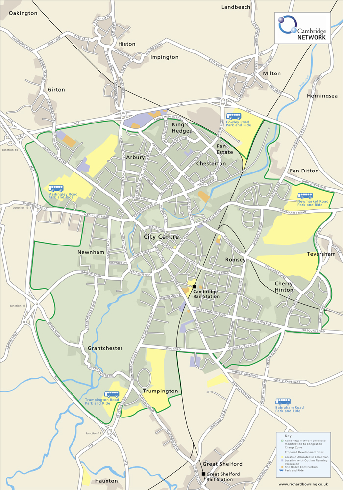
The brief from Cambridge Network was to provide a digital Illustrated map showing the proposed area of congestion charges, for the City of Cambridge. Bright colours were used on what could otherwise have been quite a dry exercise. This illustrated map of Cambridge has...
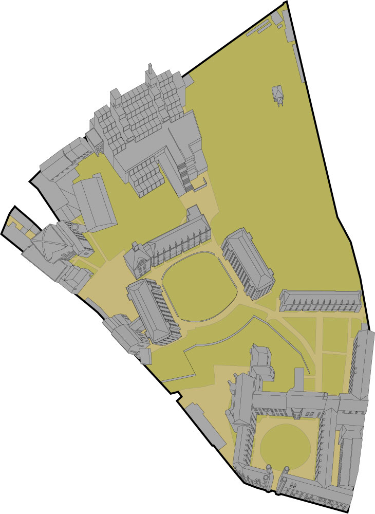
Two illustrations for Christs College and Wayfinding Consultants. The brief was to provide aerial illustrations of the buildings of Christs College but in certain cases, entrances from all sides of a quadrangle need to be seen. This created a unique set of problems...


 Commercial and wedding photography, illustration and graphic design services. Based in Cambridge.