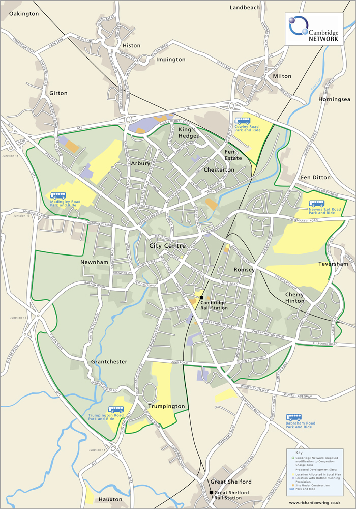
The brief from Cambridge Network was to provide a digital Illustrated map showing the proposed area of congestion charges, for the City of Cambridge. Bright colours were used on what could otherwise have been quite a dry exercise. This illustrated map of Cambridge has provided a useful template for many other cartographic projects in my home town.
Richard Bowring – Cambridge Photographer
 Commercial and wedding photography, illustration and graphic design services. Based in Cambridge.
 Telephone
01223 513 506
How can we help?
Tags
2d map illustration
3D
brochure
building illustration
business
cambridge
cartoon
chocolate
coach
computer
Digital
digital illustrated maps
digital illustratedmaps
digital map illustration
edinburgh
ely
graphic design
illustrated maps
Illustrated Mpas
illustration
illustrations of maps
lake district
landscapes
leaflet
logo
london
map
map illustration
maps
marina
people
photography
places
portrait
products
reportage
studio
technical drawing
technical illustration
technical illustrations
University
watercolour
wayfinding
wedding
wedding venue

