
 Studio portrait of Cambridge based Graphic Designer Nick Welsh.
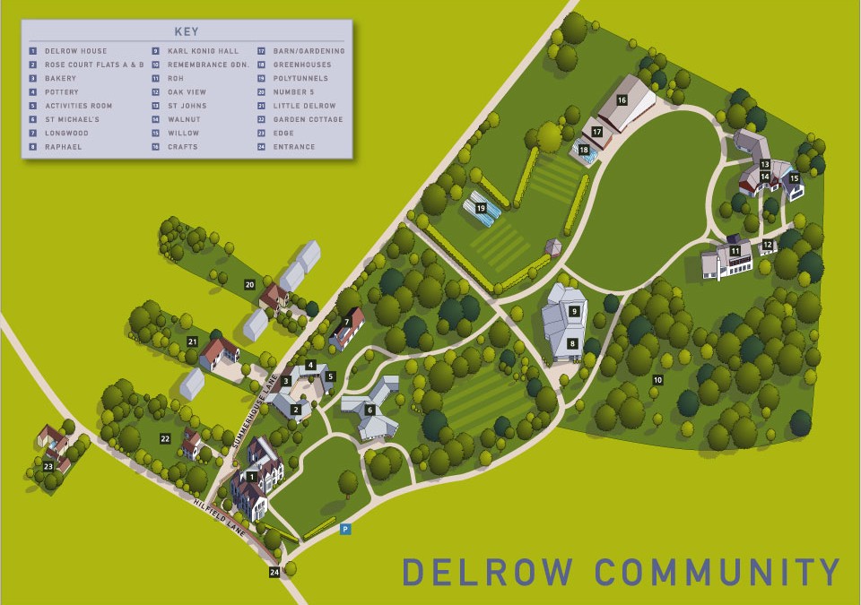 Aerial illustrated map for the Delrow community in Watford. The brief was to provide an accurate aerial view in the form of a digital 2d map showing the various accommodation and community buildings in this sheltered settlement. It was also necessary for me to allow...
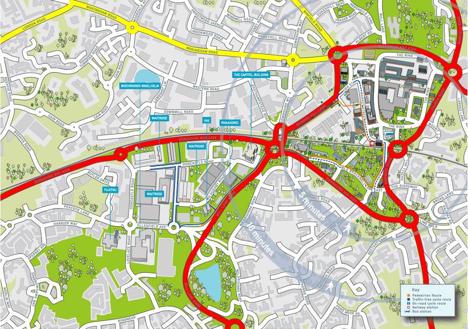 Map of the city centre area of Bracknell showing the network of cycle and walking paths that link the railway station to the southern business park. Part of the brief was also to provide accurate 2d building illustrations of some of the prominent companies that have...
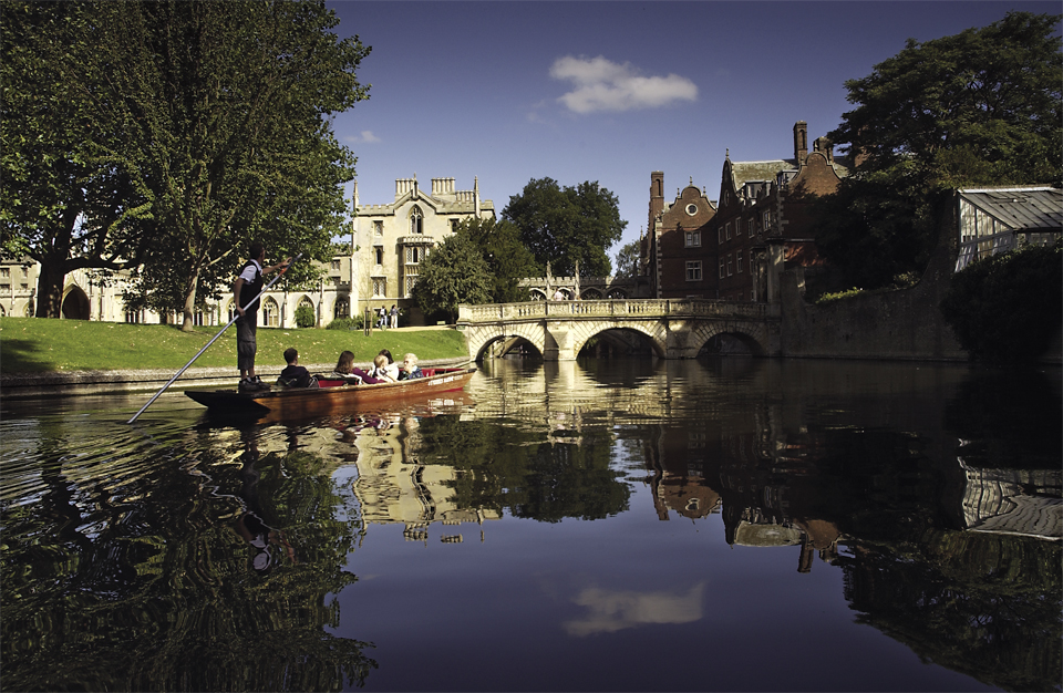 Punting towards the kitchen bridge on the River Cam in...

 Commercial and wedding photography, illustration and graphic design services. Based in Cambridge.