


Photography for Kall Kwik

Portrait of Designer Nick Welsh
Studio portrait of Cambridge based Graphic Designer Nick Welsh.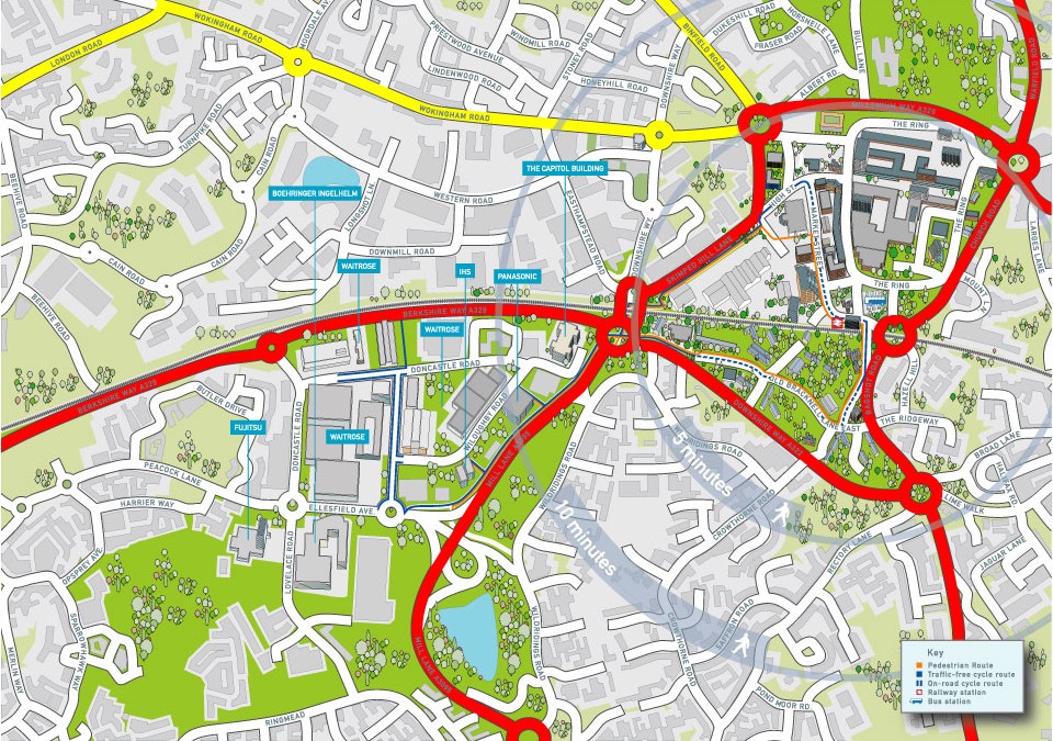
Illustrated map of Bracknell
Map of the city centre area of Bracknell showing the network of cycle and walking paths that link the railway station to the southern business park. Part of the brief was also to provide accurate 2d building illustrations of some of the prominent companies that have...
Portraits of Chocolat Chocolat owner, Isabelle Chappell
Portraits from the shoot for Chocolat Chocolat of the owner of the company Isabelle Chappell...Richard Bowring – Cambridge Photographer
 Commercial and wedding photography, illustration and graphic design services. Based in Cambridge.