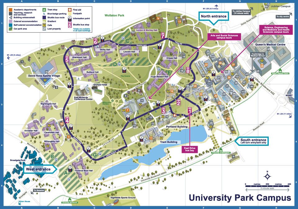
 Illustrated maps of the three campuses that make up Nottingham...
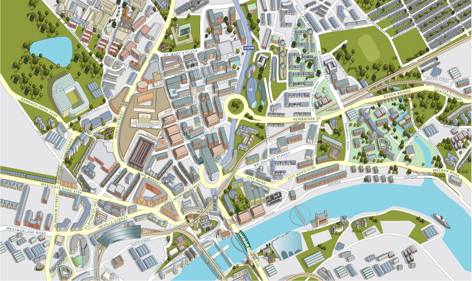 Aerial view of the city of Newcastle showing all buildings, roads and services.
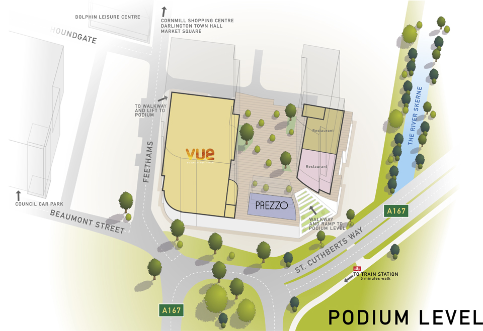 Working from Architects drawings and site photography my brief was to work out the eventual layout of the shopping development in 3D, allowing for the inclusion of information regarding which businesses are to occupy the vacant spaces...
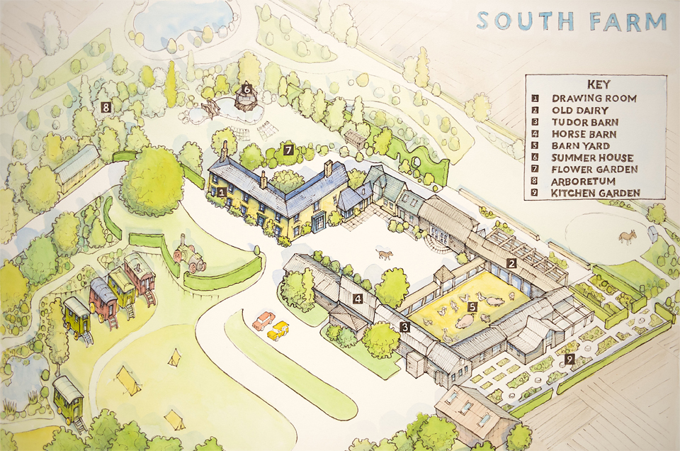 The brief was to produce an illustrated map of the venue to be handed out to guests during events. Initially a hand drawn rough map was produced, once approved we proceeded to finished artwork. The finished illustrated map was produced with watercolour on board....
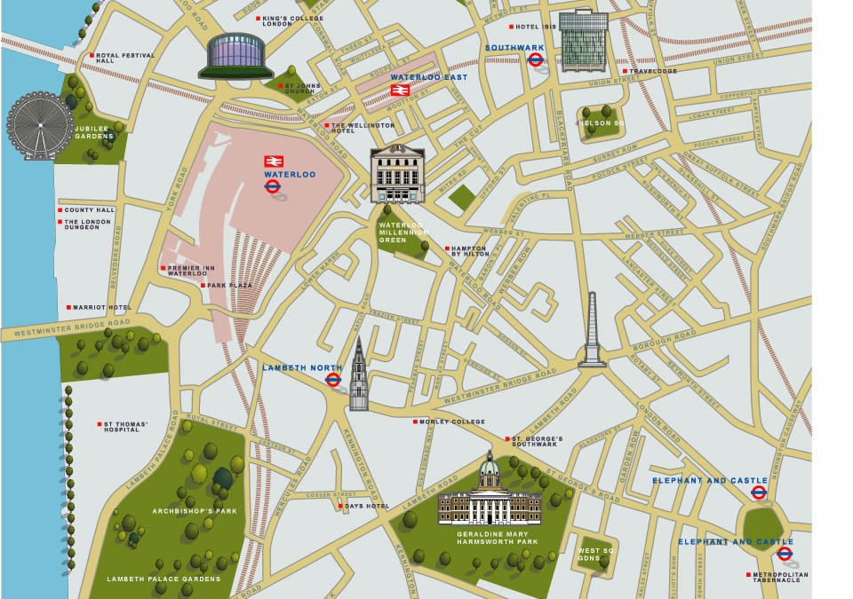 The brief was to use 2d icons of recognisable buildings to publicise the area for potential tourists. This London illustrated map was commissioned by the organisation ‘we are waterloo’ and the cartographers Lovell Johns. This particular illustrated map was...
 Illustrated Map of Leith near the city of Edinburgh. The brief was to provide an aerial digital illustration of all the key buildings in the city centre of this city in Scotland. The eventual use being on a large map and smaller hand out. Around the map, local...

 Commercial and wedding photography, illustration and graphic design services. Based in Cambridge.