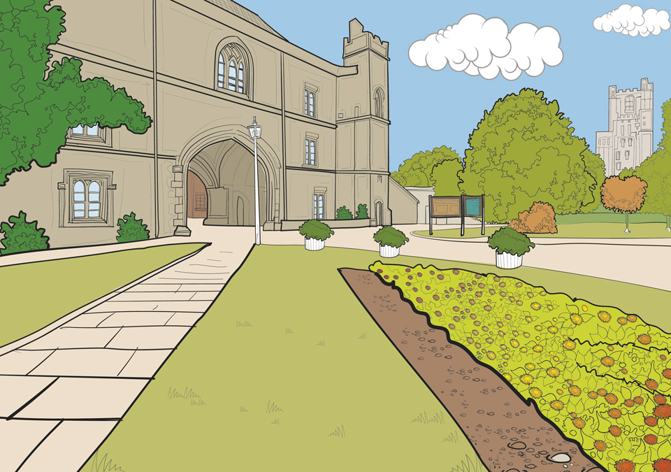
 Colouring book project focussing on the fine buildings of the City of Ely and The Kings...
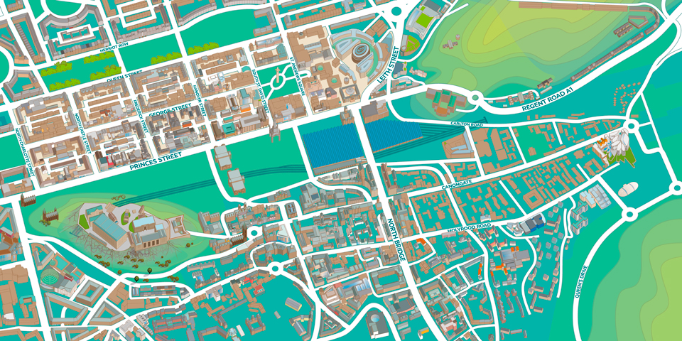 New illustrated map of Edinburgh. Digital map illustration of the central area of Edinburgh featuring both the old and new towns. Edinburgh is Scotland’s compact, hilly capital. It has a medieval Old Town and elegant Georgian New Town with gardens and...
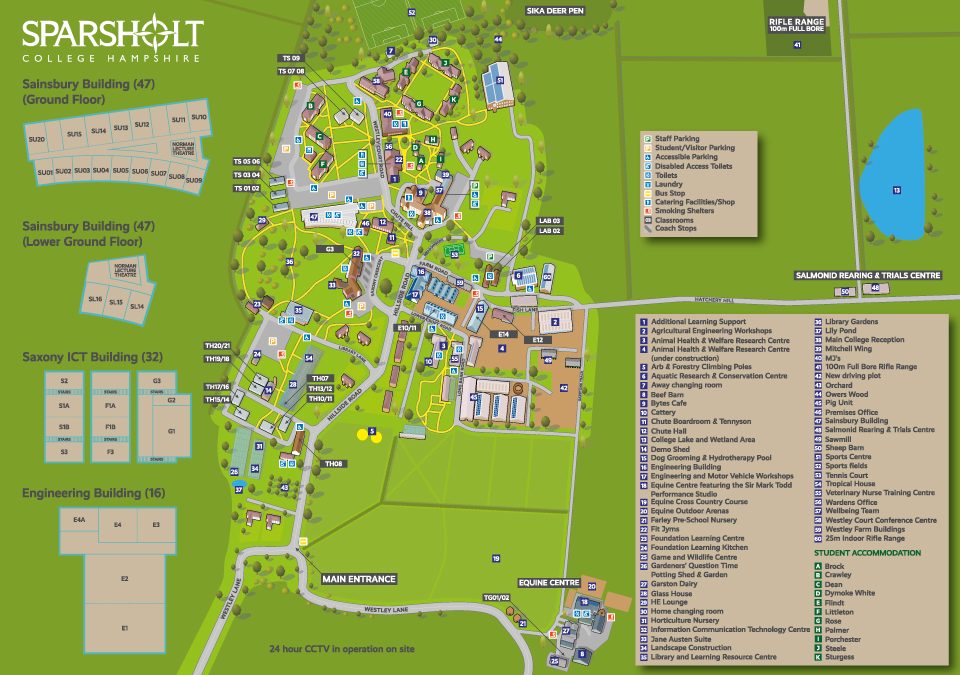 Map showing the key buildings, roads and key for Sparsholt College commissioned by Latitude Maps,...
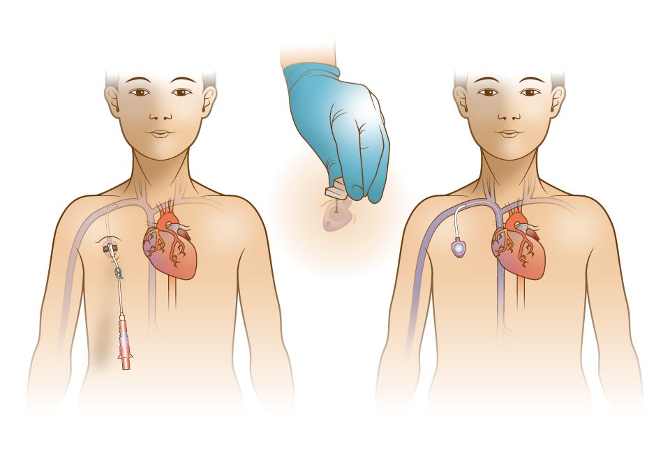 Ongoing work divided into particular medical disciplines describing in illustrative terms the procedures about to be undertaken. For Barts and Whittington Hospitals. Illustrations have now been used to create an app for clinicians to use to explain common procedures...
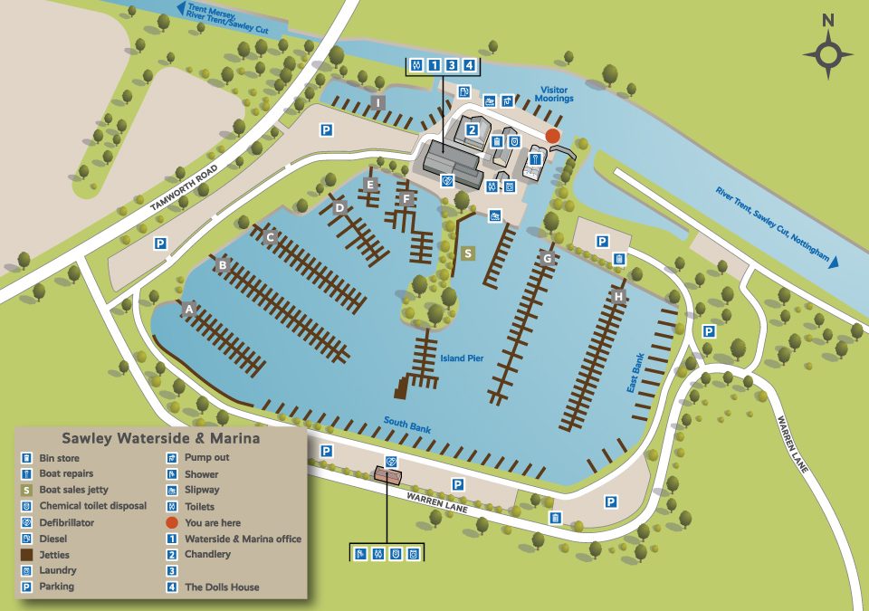 One of a series of 36 illustrative maps for British Waterways/Aquavista. The illustrations feature the marinas owned throughout the UK, I also designed a series of icons to be used throughout in the annotations. The work was commissioned by 3-sixty in...
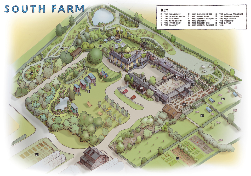 Combination of hand drawn and digital image for the wedding venue South Farm. The original drawing was produced using drone images and my own photographs. This was subsequently coloured up in...

 Commercial and wedding photography, illustration and graphic design services. Based in Cambridge.