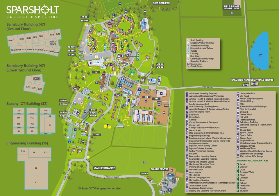
 Map showing the key buildings, roads and key for Sparsholt College commissioned by Latitude Maps,...
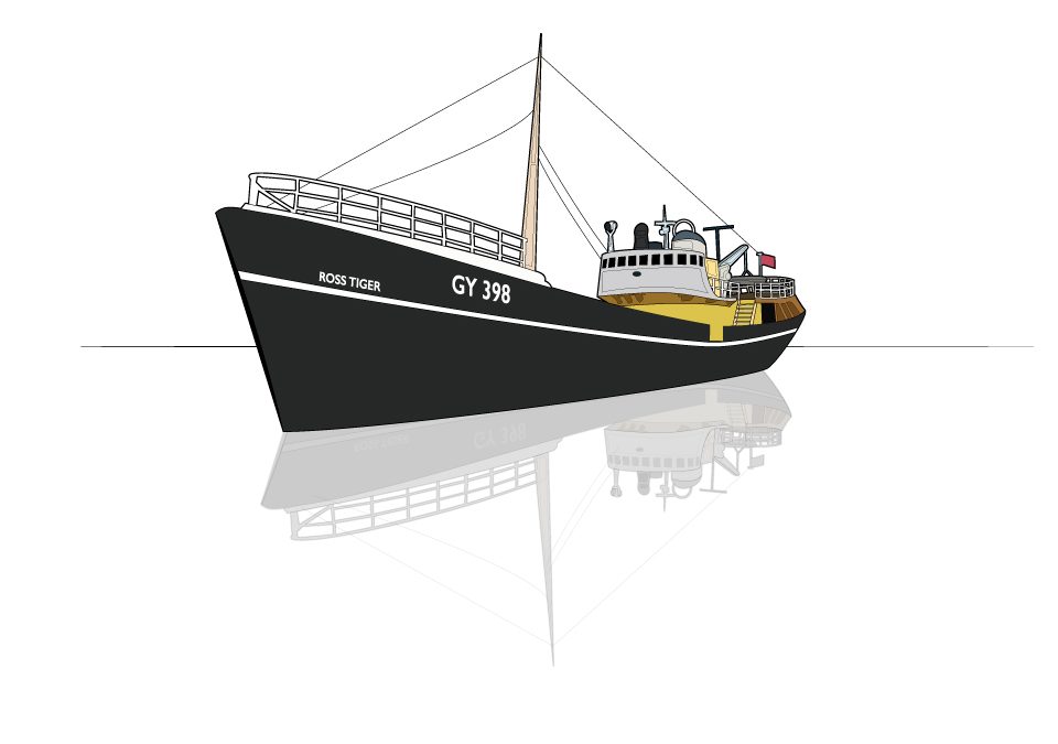
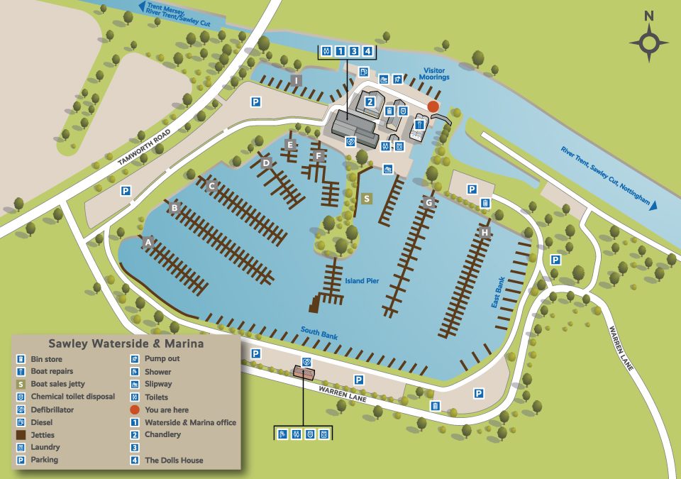 One of a series of 36 illustrative maps for British Waterways/Aquavista. The illustrations feature the marinas owned throughout the UK, I also designed a series of icons to be used throughout in the annotations. The work was commissioned by 3-sixty in...
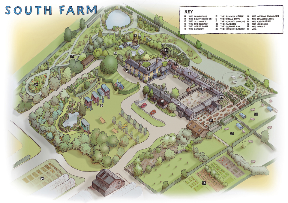 Combination of hand drawn and digital image for the wedding venue South Farm. The original drawing was produced using drone images and my own photographs. This was subsequently coloured up in...
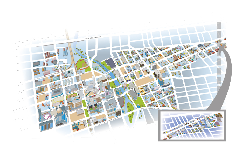 Illustrated map of the city of Reno Nevada for Lovell Johns. The brief was to produce a detailed isometric map of the area. The problems encountered were showing the skyscrapers without hiding roads behind them. The bright colours reflect the vibrant nature of the...
 Often in the production of illustrated maps it is necessary to highlight places of interest, this can be done in a number of ways. In this instance, the clients have chosen to overlay the road map with 3d digital drawings of buildings. All these buildings are...
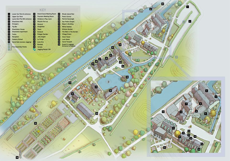 This illustrated map was shows the clients around the many buildings of this Dublin Hotel. The initial phase was conducted with several rough images being produced before approval of a full colour hand drawn version. This was then used as a template for the final...

 Commercial and wedding photography, illustration and graphic design services. Based in Cambridge.