
Latest
Maps
We specialise in cartography and offer a unique service to produce Illustrated Maps. In these, anything is possible – from a simple digital road map to a hand-drawn aerial version showing every building in a city.
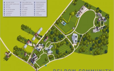
Illustrated map for the Delrow Community
Aerial illustrated map for the Delrow community in Watford. The brief was to provide an accurate aerial view in the form of a digital 2d map showing the various accommodation and community buildings in this sheltered settlement. It was also necessary for me to allow...
Illustrated map of Bracknell
Map of the city centre area of Bracknell showing the network of cycle and walking paths that link the railway station to the southern business park. Part of the brief was also to provide accurate 2d building illustrations of some of the prominent companies that have...
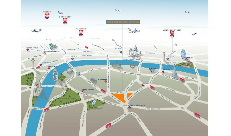
Illustrated map of South London (Southwark Campus of LSBU)
Illustrated map of South London (Southwark Campus of LSBU) and Havering Campus (Romford) This of illustrated map went through a number of incarnations before arriving at this finished result. The client wanted an illustrated map which worked in terms of being able to...
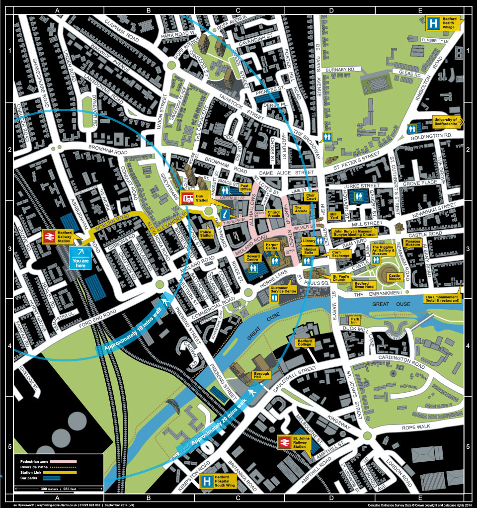
Wayfinding map of Bedford
One of my clients with which I have collaborated on many projects over the years is Wayfinding Cosultants. Wayfinding refers to information systems that guide people through a physical environment and enhance their understanding and experience of the space. My part in...
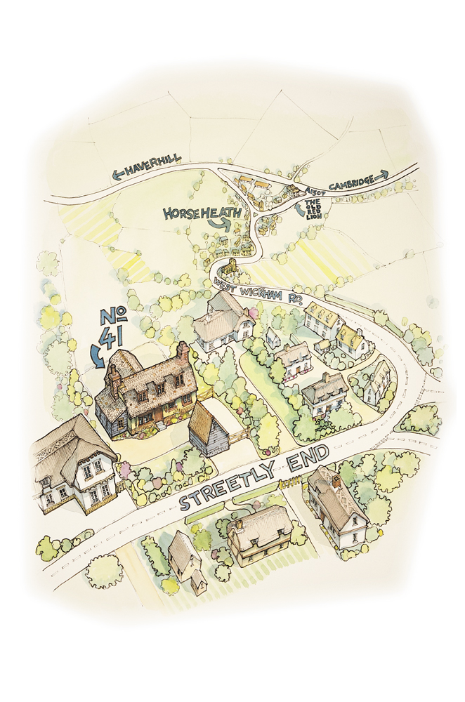
Illustrated Map for Book Keepers Plus
Local accountancy and bookkeeping company Bookeepers Plus approached me with an idea for a 'how to find us' type of map, helping to give directions to their new premises. They liked the look of my previous examples of hand drawn illustrated maps, so it just remained...

Illustrated map of Grantchester Meadows, Cambridge for Scudamores Boatyards
The brief was to provide a fun and informative, hand drawn Illustrated map of Grantchester Meadows, Cambridge for Scudamores Boatyards. The map needed to show various things including the walking route from the boathouse in the city centre, the punting route via the...
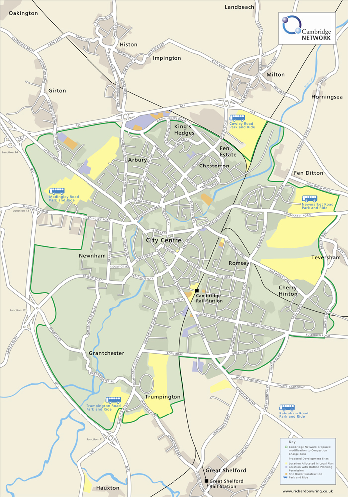
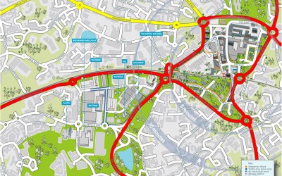
Illustrated Map of Congestion Charges for Cambridge Network
The brief from Cambridge Network was to provide a digital Illustrated map showing the proposed area of congestion charges, for the City of Cambridge. Bright colours were used on what could otherwise have been quite a dry exercise. This illustrated map of Cambridge has...
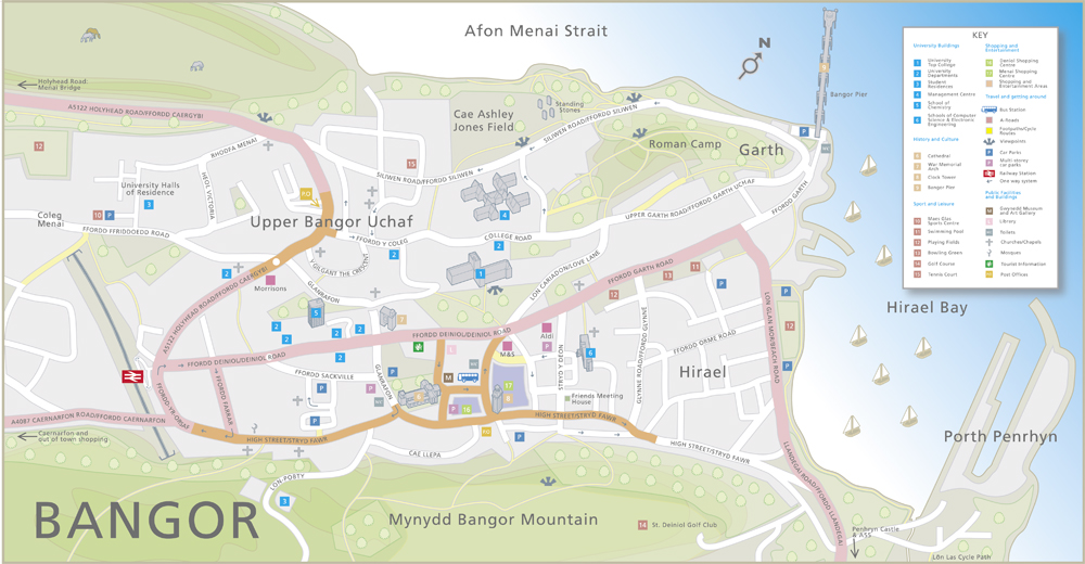
Map of the City of Bangor
A complex project for the City of Bangor in Wales. The brief was to provide an informative and fun map of the area including a detailed key of the important places of business, leisure and education. Also, given the undulating nature of the topography, give an...

Technical illustration for The City of Inverness
Another project for Mobimaps, this time an aerial illustrated map of the entire central City of Inverness. A real labour of love as you can probably see but as with all these large projects, the end justifies the means. A combination of aerial photography and Google...