
Latest
Maps
We specialise in cartography and offer a unique service to produce Illustrated Maps. In these, anything is possible – from a simple digital road map to a hand-drawn aerial version showing every building in a city.
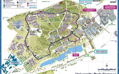
New illustrated maps for Nottingham University
Illustrated maps of the three campuses that make up Nottingham University
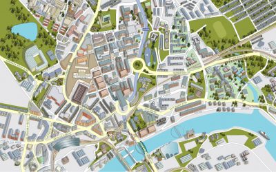
Illustrated map of Newcastle City Centre
Aerial view of the city of Newcastle showing all buildings, roads and services.
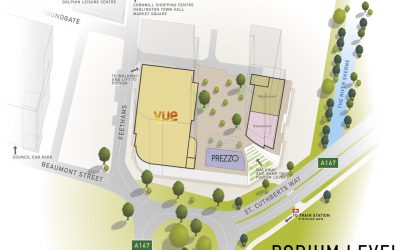
Illustrated map of the Feethams Shopping development in Darlington
Working from Architects drawings and site photography my brief was to work out the eventual layout of the shopping development in 3D, allowing for the inclusion of information regarding which businesses are to occupy the vacant spaces within.
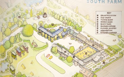
Map for the wedding venue South Farm
The brief was to produce an illustrated map of the venue to be handed out to guests during events. Initially a hand drawn rough map was produced, once approved we proceeded to finished artwork. The finished illustrated map was produced with watercolour on board....
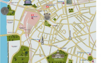
Illustrated map of Waterloo
The brief was to use 2d icons of recognisable buildings to publicise the area for potential tourists. This London illustrated map was commissioned by the organisation 'we are waterloo' and the cartographers Lovell Johns. This particular illustrated map was produced in...
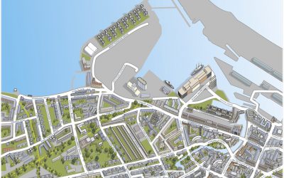
Map of Leith
Illustrated Map of Leith near the city of Edinburgh. The brief was to provide an aerial digital illustration of all the key buildings in the city centre of this city in Scotland. The eventual use being on a large map and smaller hand out. Around the map, local...
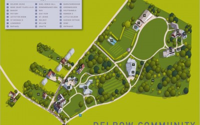
Illustrated map for the Delrow Community
Aerial illustrated map for the Delrow community in Watford. The brief was to provide an accurate aerial view in the form of a digital 2d map showing the various accommodation and community buildings in this sheltered settlement. It was also necessary for me to allow...
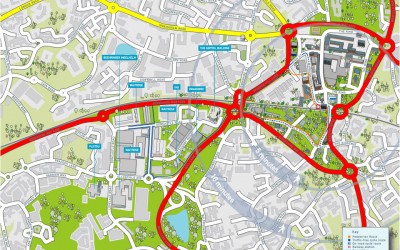
Illustrated map of Bracknell
Map of the city centre area of Bracknell showing the network of cycle and walking paths that link the railway station to the southern business park. Part of the brief was also to provide accurate 2d building illustrations of some of the prominent companies that have...
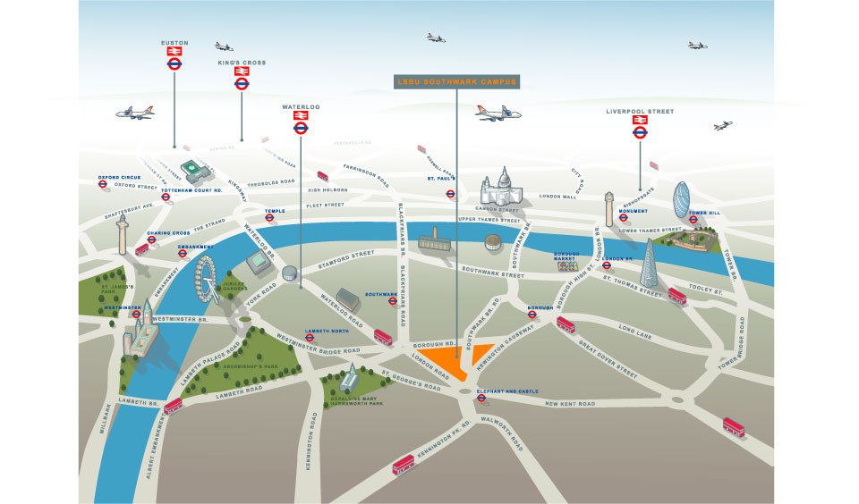
Illustrated map of South London (Southwark Campus of LSBU)
Illustrated map of South London (Southwark Campus of LSBU) and Havering Campus (Romford) This of illustrated map went through a number of incarnations before arriving at this finished result. The client wanted an illustrated map which worked in terms of being able to...