
Services
Illustration
Maps
We specialise in cartography and offer a unique service to produce Illustrated Maps. In these, anything is possible – from a simple digital road map to a hand-drawn aerial version showing every building in a city.
General Illustration
Illustration
Richard Bowring Illustration
Illustration in all its forms is a large part of our business, we work in both traditional and digital media, from a simple line drawing to a complex computer created illustration.
Project Brief
Tell me about your project and vision.
Project Planning
Plan and budget with your input at the forefront.
Project Execution
I’ll make your vision a reality.

Think, Imagine, Commission
Your business is unique and your illustrations should demonstrate this. Ditch the same stock images that other people are using. Commission your own commercial illustrations.
01
Think about your illustration needs.
02
Imagine how they will look.
03
Commission me to make your vision a reality.
latest Illustration work
Illustration Blog
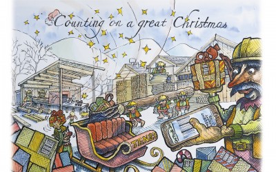
Watercolour illustration for Ten-25
Illustration for the software company Ten-25 and Spirus Marketing
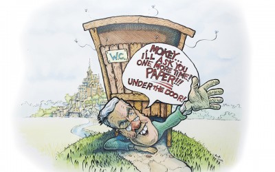
Watercolour cartoon for Golden Wedding celebrations
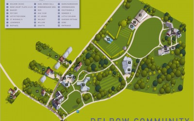
Illustrated map for the Delrow Community
Aerial illustrated map for the Delrow community in Watford. The brief was to provide an accurate aerial view in the form of a digital 2d map showing the various accommodation and community buildings in this sheltered settlement. It was also necessary for me to allow...
Get Started
Let’s Work Together

Illustration in all its forms is a large part of our business, we work in both traditional and digital media, from a simple line drawing to a complex computer created illustration.