
Latest
Maps
We specialise in cartography and offer a unique service to produce Illustrated Maps. In these, anything is possible – from a simple digital road map to a hand-drawn aerial version showing every building in a city.
Building drawings for illustrated maps
Often in the production of illustrated maps it is necessary to highlight places of interest, this can be done in a number of ways. In this instance, the clients have chosen to overlay the road map with 3d digital drawings of buildings. All these buildings are...
Illustrated map for Cliff at Lyons Hotel
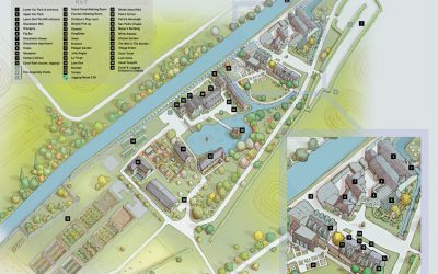
This illustrated map was shows the clients around the many buildings of this Dublin Hotel. The initial phase was conducted with several rough images being produced before approval of a full colour hand drawn version. This was then used as a template for the final...
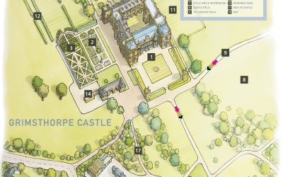
Map illustration of Grimsthorpe Castle
Hand drawn illustrated map and walking guide for Grimsthorpe Castle, the work includes an aerial watercolour illustrated map of the castle and an accompanying digital 2D walking map showing the leisure activities available in the grounds.
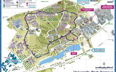
New illustrated maps for Nottingham University
Illustrated maps of the three campuses that make up Nottingham University
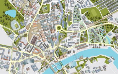
Illustrated map of Newcastle City Centre
Aerial view of the city of Newcastle showing all buildings, roads and services.
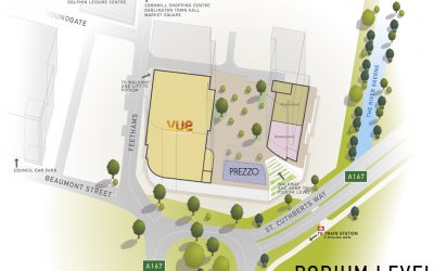
Illustrated map of the Feethams Shopping development in Darlington
Working from Architects drawings and site photography my brief was to work out the eventual layout of the shopping development in 3D, allowing for the inclusion of information regarding which businesses are to occupy the vacant spaces within.
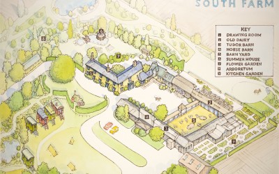
Map for the wedding venue South Farm
The brief was to produce an illustrated map of the venue to be handed out to guests during events. Initially a hand drawn rough map was produced, once approved we proceeded to finished artwork. The finished illustrated map was produced with watercolour on board....
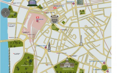
Illustrated map of Waterloo
The brief was to use 2d icons of recognisable buildings to publicise the area for potential tourists. This London illustrated map was commissioned by the organisation 'we are waterloo' and the cartographers Lovell Johns. This particular illustrated map was produced in...
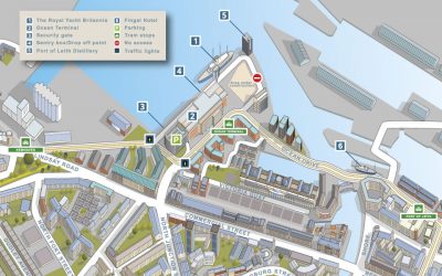
Map of Leith and surrounding area for The Royal Yacht Britannia
Illustrated Map of Leith near the city of Edinburgh. The brief was to provide an aerial digital illustration of all the key buildings in the city centre of this city in Scotland. The eventual use being on a large map and smaller hand out. Around the map, local...