
Latest
Maps
We specialise in cartography and offer a unique service to produce Illustrated Maps. In these, anything is possible – from a simple digital road map to a hand-drawn aerial version showing every building in a city.
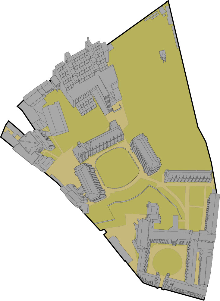
Illustrated Maps for Wayfinding Consultants
Two illustrations for Christs College and Wayfinding Consultants. The brief was to provide aerial illustrations of the buildings of Christs College but in certain cases, entrances from all sides of a quadrangle need to be seen. This created a unique set of problems...

Ely City Guide Map Illustrations
A digital illustration for the city guide map of Ely. The double sided map included photography and illustration and three maps of Ely and the surrounding area. The brief was to provide an underlying illustrated map of the area while overlaying key buildings in a...